Prairie Mountain
Kananaskis Country
Type of Site: Hike & Fly Mountain Site (PG)
Total Height: 671m
This is an “all seasons” hike and fly site in the eastern end of Kananaskis Country. The grassy slopes on top of this well hiked foothill offer a wealth of low stress launching directions. This site is a favorite for local hike-and-fly enthusiasts, and is a nice alternative for when the Bow Valley winds roar through the nearby Canmore flying sites.
Access: Drive along Alberta Highway 66 until you reach the Elbow Falls Provincial Recreation Area. Park either in the Elbow Falls parking lot, or along the shoulder of the highway itself, just outside the gate. The hike itself is 3.2km one way, with approximately 666m of elevation gain. The trail starts with an abrupt climb from the highway, followed by a brief flat section. After about a kilometer of gentle grade, you will be met with an unrelenting grind through the trees up the rest of the hill. The last 20% or so of the hike is above treeline, and is relatively easy. The hike itself should take anywhere between 1.5 and 2.5 hours, depending on the weight of your kit, and how much mountain goat blood you have flowing through your veins.
Outside of summer, consider brining Yaktrax or equivalent shoe coverings for the hike. The trail can get icy, especially during the freeze-thaw cycles of the spring.
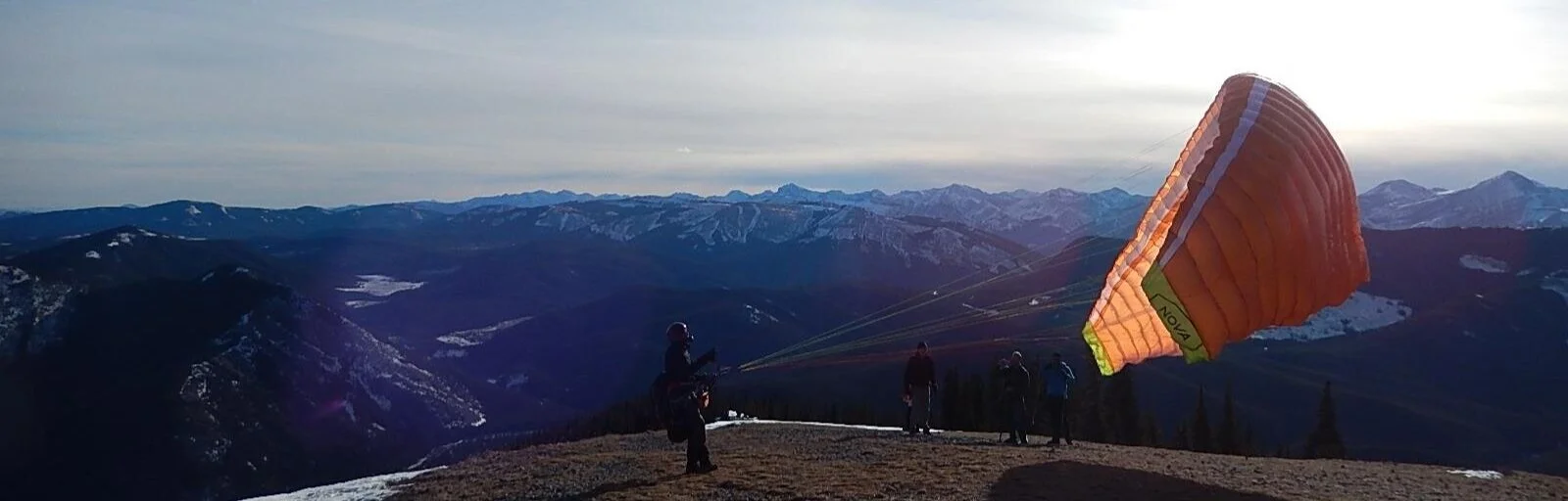
Launch: Most pilots will launch along the glaciated summit block that has a mixture of grass and talus, facing to the Southwest. There is ample room for no wind launches, but pilots should be aware of the trees not too far below launch. Pilots P2 and up should be capable of using the SW launch.
There is also a less frequented option of launching to the Northeast. This is a cliff launch and comes with its own set of inherent risks, including exposure, and rotor. Only pilots with their P3 and previous cliff-launch / mountain launch experience should attempt the Northeast option.
Landing: The landing area is a grassy clearing directly NW of highway 66. The field may look flat from the air, but is actually slightly sloped towards the South. Take care to note your groundspeed, the height of the trees, and the slope of the ground before your landing attempt.

The field itself is arguably either just inside, or just outside the Elbow Falls Provincial Recreation Area, depending on which set of maps you are looking at. If Parks authorities stop to question you, please be courteous and explain what you are up to, as well as your interpretation of the boundaries. They will generally be understanding. DO NOT land on the road, unless an emergency demands that you do so.
Bailouts between launch and landing are sparse, to say the least. Unless you gain immediate height over the summit, head out to the landing area as early as possible. Try your best to anticipate any valley flow before positioning yourself over the landing field.
Airspace: The takeoff for this site is within the Calgary CAE (Class E), extending from 5,800ft to overflying airspace. The Calgary TCA starts approximately 6km East of the site, and extends from 8,000ft to 12,500ft. The boundary is marked on the ground by the Paddy Flats campground. Flying a paraglider is not permitted in Class C airspace.
XC Options: XC is limited as you are sandwiched between the Calgary TCA on the East, and the
Provincial Park boundary on the west. If you gain height, and out & return to Moose Mountain is a reasonable goal. There are bailouts available in the valley below, but be aware of venturi if you happen to sink out.
Site Weather Station Links:
Site Weather Forecast Links:
http://canadarasp.com/windgrams/?region=9&location=15&plotType=0
https://www.windy.com/50.888/-114.807/wind?50.403,-114.807,8
Additional Links:
https://paraglidingearth.com/?site=16189
Local Contact:
Brandon Hopkins - ab.hgpg.association@gmail.com